
The US Geological Survey (USGS) has been a long-time provider of geospatial data, many of you may have used the National Map Seamless Sever to download USGS data in the past, which has since been succeed by the National Map Viewer (https://viewer.nationalmap.gov/basic/). This article will look at some additional USGS data portals that may be of particular interest to GIS students, educators, and professionals.
- The Advanced Viewer for the National Map (https://viewer.nationalmap.gov/advanced-viewer/): This is a handy Esri web mapping application that not allows you to display USGS layers, but you can also add in layers from ArcGIS Online (including those from your own ArcGIS Online accounts), as well as perform on-the-fly analyses with the application’s built-in elevation profile tool and ring-buffer tool.
- The Lidar Point Cloud Viewer (http://prd-tnm.s3.amazonaws.com/LidarExplorer/index.html#/): This is a USGS viewer that enables you to find out if DEM (Digital Elevation Model) and LiDAR (Light Detection and Ranging) data are available in your study area, filter out DEM and LiDAR data that meet your data quality requirements, and preview the data prior to downloading them.
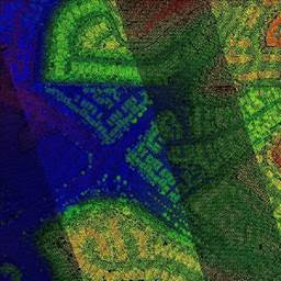
Preview of USGS Lidar Point Cloud (LPC) in a San Diego Neighborhood
- The 3D Elevation Program (3DEP) Viewer (https://apps.nationalmap.gov/3depdem/): This viewer allows you to visualize and download a variety of DEM derived products for the entire country, such as hillshade, slope, aspect, and contour maps. Moreover, similar to the Advanced Viewer, you can add in your own data from ArcGIS Online in order to perform quick visual analyses of your data against these DEM derived products.
This article only highlighted some of the USGS’ data portals and web applications that were introduced at this year’s American Association of Geographers Annual Meeting, there are many more USGS products that you can explore on your own at https://viewer.nationalmap.gov/apps/.
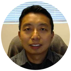
Wing Cheung, PhD
Principal Investigator, UASTEP
Wing Cheung is the Principal Investigator of the UASTEP project. He is a Professor of Geography and the Chairman of the Earth, Space and Environmental Sciences department at Palomar College. He is also the Coordinator of the Geographic Information Science as well as the Environmental Studies programs. In addition to hosting outreach events and UAS workshops for high school students, he develops UAS curriculum and oversees the creation of the UAS Associate’s Degree at Palomar College.