
About UASTEP
The UASTEP project is a collaboration between Palomar College and Southwestern College, as well as their partner high school districts, universities, and various industry partners. The project team will involve industry professionals and veterans in the development of industry-specific UAS courses, develop new academic programs and educational pathways, host professional development workshops for educators, cultivate students’ business and workplace competencies, and host summer academies as well as outreach events to excite underrepresented high school and college students about UAS educational and career pathways. This project will not only increase the number of skilled UAS technicians in the workforce, but also seeks to foster interest in UAS among faculty members and students from different disciplines. The Massive Open Online Course (MOOC) developed from this project will also provide broad societal benefits by educating the public about the safe and novel applications of UAS, thus fostering a responsible culture for UAS operations and building further excitement around UAS careers.
Senior Personnel

Wing Cheung
Principal Investigator
Wing Cheung is the Principal Investigator of the UASTEP project. He is a Professor of Geography and the Co-Founder of the Drone Technology program at Palomar College. He is also the Coordinator of the Geographic Information Science as well as the Environmental Studies programs. In addition to hosting outreach events and UAS workshops for high school students, he will develop UAS curriculum and oversee the creation of the UAS Associate’s Degree at Palomar College.

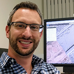
Kenneth Yanow
Co-Principal Investigator
Kenneth Yanow is the Co-Principal Investigator of the UASTEP project. He has been a Professor of Geographical Sciences at Southwestern College (SWC) for the past 16 years, and directs the Geospatial Technology (GST) program at SWC. As the Associate Director of the National GeoTech Center, he has led annual professional development workshops for educators for the past seven years. He will be responsible for curriculum and program development at Southwestern College, as well as coordinate UAS competitions at high schools and UAS workshops for educators.

Mark Bealo
Co-Principal Investigator
Mark Bealo is the Co-Principal Investigator of the UASTEP project. He is a Professor of Graphic Communications at Palomar College, and the primary instructor and curriculum developer for the introductory and advanced Digital Imaging with UAS classes currently offered at the College. He will develop UAS curriculum and program at Palomar College, and coordinate a variety of student outreach events as well as workshops for high school students and educators.

Sean Figg
Co-Principal Investigator
Sean Figg is currently a Professor of Geology and the Coordinator of the Geology program at Palomar College in San Marcos. Sean’s academic and research experience are in the fields of geochemistry and geochronology. He is a strong believer in using emerging technologies, both inside the classroom and in the field, and has introduced his students to the techniques and applications of GPS and GIS in his field courses.
Supporting Personnel

Candiya Mann
External Evaluator
Candiya Mann is the external evaluator of this project. She is the Senior Research Manager at Washington State University, and serves as the evaluator for several ATE Centers, in addition to NSF ITEST and IUSE projects and other federal, state, and community projects.
Jochen Schubert
Jochen Schubert will assist in the design and implementation of the UAS workshops for high school students and professional development. He is a geomatics and hydraulic modeling Research Specialist at UC Irvine, in the Department of Civil and Environmental Engineering. His research work leverages low-cost drones to collect essential data for flood hazard modeling in data scarce regions, and to observe beach dynamics in Southern California.

Michelle Palmer
Consultant - Web, Social Media, Graphic Design
Michelle Palmer will assist in creation of outreach materials (logos, banners, brochures, advertisements, promotional items) and the development and management of the web and social media presence for UASTEP. Michelle has a background creating websites, graphic designs and marketing videos.
Partners
Industry Partners
ESRI
City of San Marcos
SlantRange
Navy: Naval Air Systems Command
San Diego State University
Urban and Regional Information Systems Association (URISA)
San Diego Regional Economic Development Corporation
Fallbrook Land Conservancy
Compass Rose GIS
U.S. Geological Survey
SDG&E
Escondido Creek Conservancy
Modus Robotics
AirSpace Consulting
Birds Eye Aerial Drones, LLC